Llanddwyn Island
Overview
Llanddwyn Island or Ynys Llanddwyn (in Welsh) is a small tidal island off the west coast of Anglesey. It remains attached to the mainland except at high tide and provides views of Snowdonia and the Llŷn Peninsula.
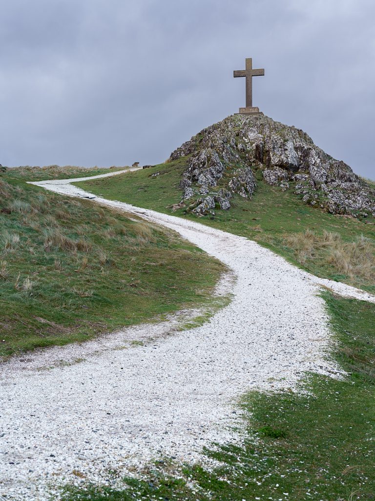
The island boasts abundant history, nature, and beauty. The island has two picturesque lighthouses, a ruined 16th-century chapel and many rocky coves. There is also a small terrace of 4 pilot houses built for pilots who guided ships through the treacherous Menai Straits, and who manned the Llanddwyn lifeboat until 1903. A variety of seabirds can be spotted from the island, as well as seals – heads bobbing in the water, or basking on the nearby rocks. If you’re lucky, you may also spot dolphins or even the occasional Minke Whale.
But we come for the photography 🙂
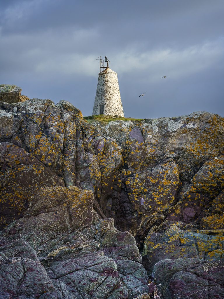
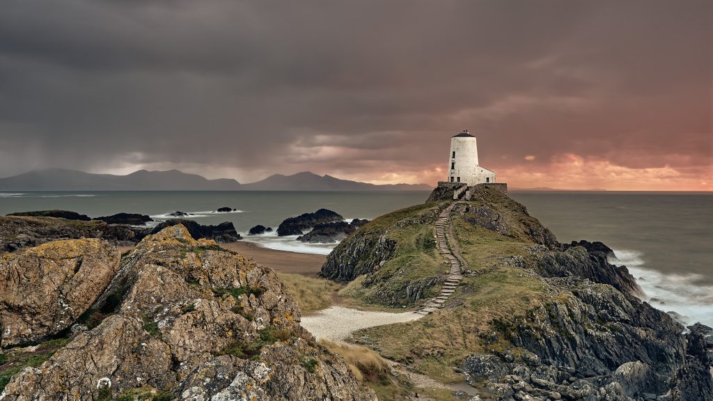
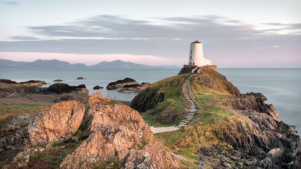
The most popular photographic feature is the lighthouse on the tip of the island Tŵr Mawr lighthouse which marks the western entrance to the Menai Strait which separates the island of Anglesey from the mainland of North Wales. By far the most popular composition of the lighthouse is shot from the small outcrop of rock marked A on the route map below. In fact it is so popular a viewpoint that the grass has been worn bare by many photographers feet and tripods!
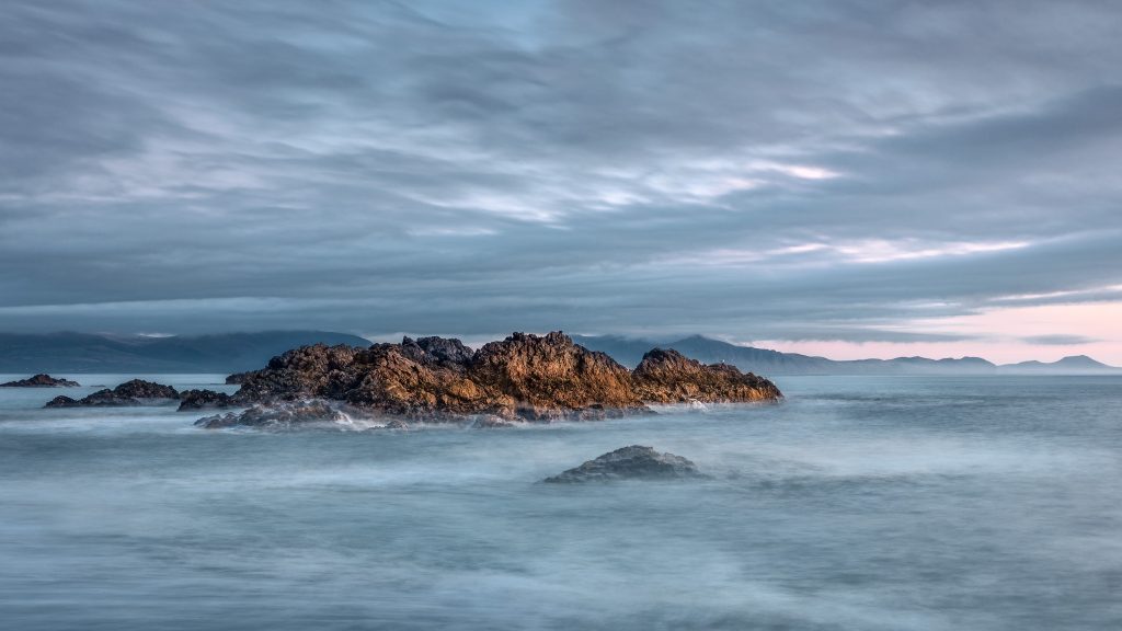
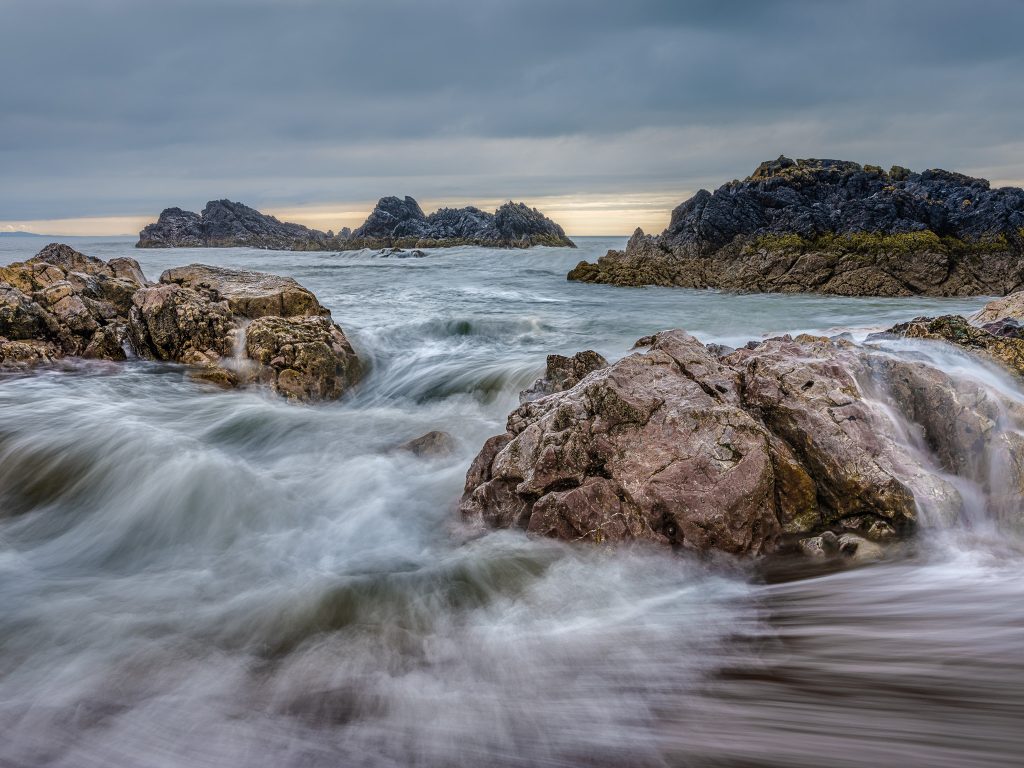
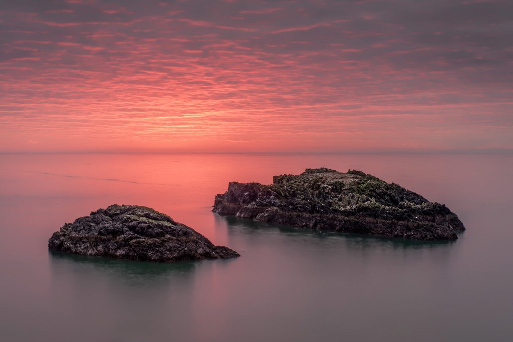
However, to me there is far more to this island than just the lighthouse. One of my favourite spots is the small beach of Porth Twr Bach marked B on the map below. Here you will find a wonderful mix of rocks including rose pink quartzites, greenish lavas, pale limestones, dark coloured intrusive dykes, and purple manganese rich shales, all folded and mixed together. This amazing mixture of colours and textures provides great opportunities for intimate landscapes.
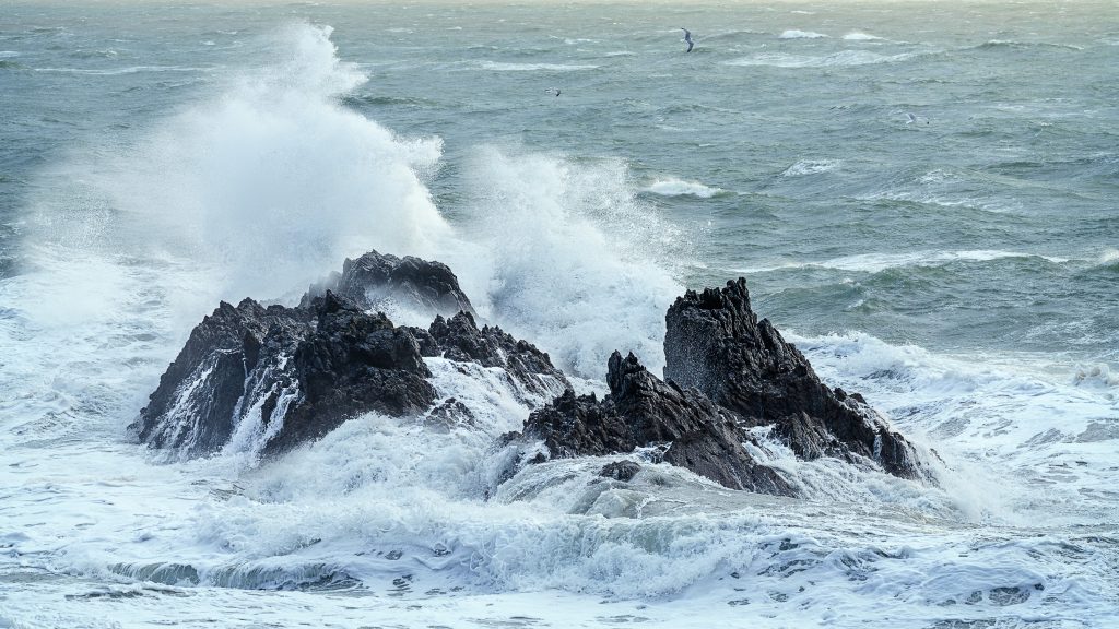
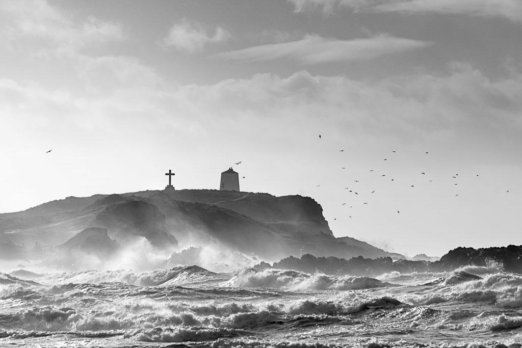
The best time to visit is for sunset with the lighthouse and mountains of the Llŷn Peninsula glowing with the last light. It you can manage the conditions, another, albeit much harder time to visit, would be during a good winter storm where the sea and rocky islets come alive with crashing waves.
Location Information
Location’s Area
Newborough : Anglesey : North Wales
Photography Genre
Coast / Seascape
View Tide Times for this location
Access Difficulty
Easy – Fairly flat walking; mostly beach then rough paths on the islands.
Time to Location
41 minutes
Distance to Location
1.68 miles
Elevation Climbed
32 feet
Parking
Paid Car Park in Newborough Forest
£7 for the day; pay on exit.
View on Google Maps
Warning: The island is generally cut-off at high tide so you may have to wait until you can cross. I have found anything over 4m and the island is cut-off; but this does depend on the weather conditions. If you are visiting for a sunset, you are best to plan your day when there is a falling tide, otherwise you could end up waiting for a couple of hours in the dark.
All information correct as of January 2023
Directions
It couldn’t be easier to get to this location. Leave the car park and head onto the beach, turn right and follow the shoreline to the island. It is worth noting that if you wait for sunset and then head back in the falling light, you need to be conscious where the exit from the beach into the carpark is. As I have have found out, missing the exit means a much further walk thank expected 🙂
Download file for GPSSome images captured at this location: –